


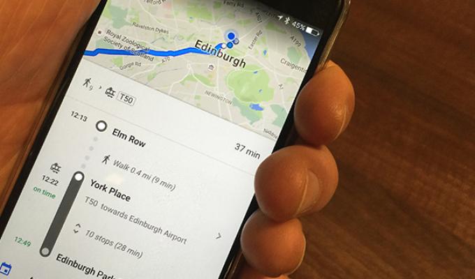
Bus and tram passengers in Edinburgh will be the first in Scotland to access real-time service information in Google Maps. From 4th January the partnership between Transport for Edinburgh and Google will help travellers to plan their journeys more effectively and get live updates.
Google Maps will know where all buses and trams are on the network at any time, allowing it to show expected times of arrival and any service delays, and the information will be incorporated into Google Maps' journey planning functions.
The new technology is also fully integrated with the Transport for Edinburgh app and the websites for Lothian Buses and Edinburgh Trams.
What this means for our passengers
- Live journey planning is now available on Google Maps on desktop and mobile, lothianbuses.com, edinburghtrams.com and the Transport for Edinburgh app for iOS and Android
- When you plan a journey, it takes any delays or diversions into account - and gives you journeys with up-to-the minute ETAs
- If a bus or tram is delayed, you'll be shown alternate journeys that will get you to your destination quicker
John McEvoy, Digital Designer said:
We know how important it is for our customers to have timely and accurate information so we’re really pleased that we’ve been able to work with Google on being the first Scottish city to introduce this service. With our travel and mobile ticketing apps, and free wi-fi across the bus and trams fleet, we’re continuing to make use of technology to provide our customers with an even better experience.
Transport data specialists ITO World and the City of Edinburgh Council have also supported the initiative. As an agency for Google's public transit data, ITO provides data conversion and quality improvement services to help ensure public transport information in Google Maps is as consistently accurate as possible.